Chief Meteorologist, WXIX TV, FOX19, Cincinnati, OH, USA
| Hello from the community of Madisonville, Cincinnati, Ohio, USA North Latitude 39.1532° West Longitude 84.4003° Elevation 606 ft. (184.7 m.) MSL |
||||||||||||
| |
| @nwsiln 2018 TORNADO WARNING TRACKER | ||||||||||||
| 2018 Tornado Warnings Issued by NWS, Wilmington, Ohio False Alarms, Verifications, Tornadoes Not Warned and Related Statistics See Note 1 Below | ||||||||||||
| Animated gifs - radar reflectivity and base velocity of each verified warning are in the next table. | ||||||||||||
| Updated 08.22.2018 |
2018 Tornado Warnings To Date: 18 |
False Alarms To Date: 13 FA Rate 72% |
Verified To Date: 5 Ver Rate 28% |
Not Warned To Date: ZERO NW Rate 0% |
||||||||
| @nwsiln issued ZERO Tornado Warnings During January 2018 | ||||||||||||
| @nwsiln issued 3 Tornado Warnings During February 2018 | ||||||||||||
| Date UTC Date Local |
Time Warning Issued UTC (EST/EDT) |
Warning Fate UTC (EST/EDT) Note 2 Below |
LINK to Full Info Note 3 Below |
Verified (V)(Tor#) False Alarm (FA) Tornado Missed (M) Under Investigation (UI) + EF?(MAX W) Path Length/Time On Grnd Path Width # Inj/# Fatalities Nearest Town |
# Warnings to Date Note 1 Below |
#False Alarms to Date |
FA Rate to Date #FA ÷ #Warn x 100 = % |
#Verifications to Date |
Verification Rate to Date #V ÷ #Warn x 100 = % |
# Missed to Date |
Missed Rate to Date #M ÷ #Tor x 100 = % |
|
| 21FEB 21FEB TW#1 |
09:38 (04:38) |
Cancelled 09:49 (04:49) |
Full Info Link |
FA | 1 | 1 | 100% | 0 | 0% | 0 | 0% | |
| 25FEB 24FEB TW#2 |
04:45 (23:45) |
Cancelled 04:59 (23:59) |
Full Info Link |
FA | 2 | 2 | 100% | 0 | 0% | 0 | 0% | |
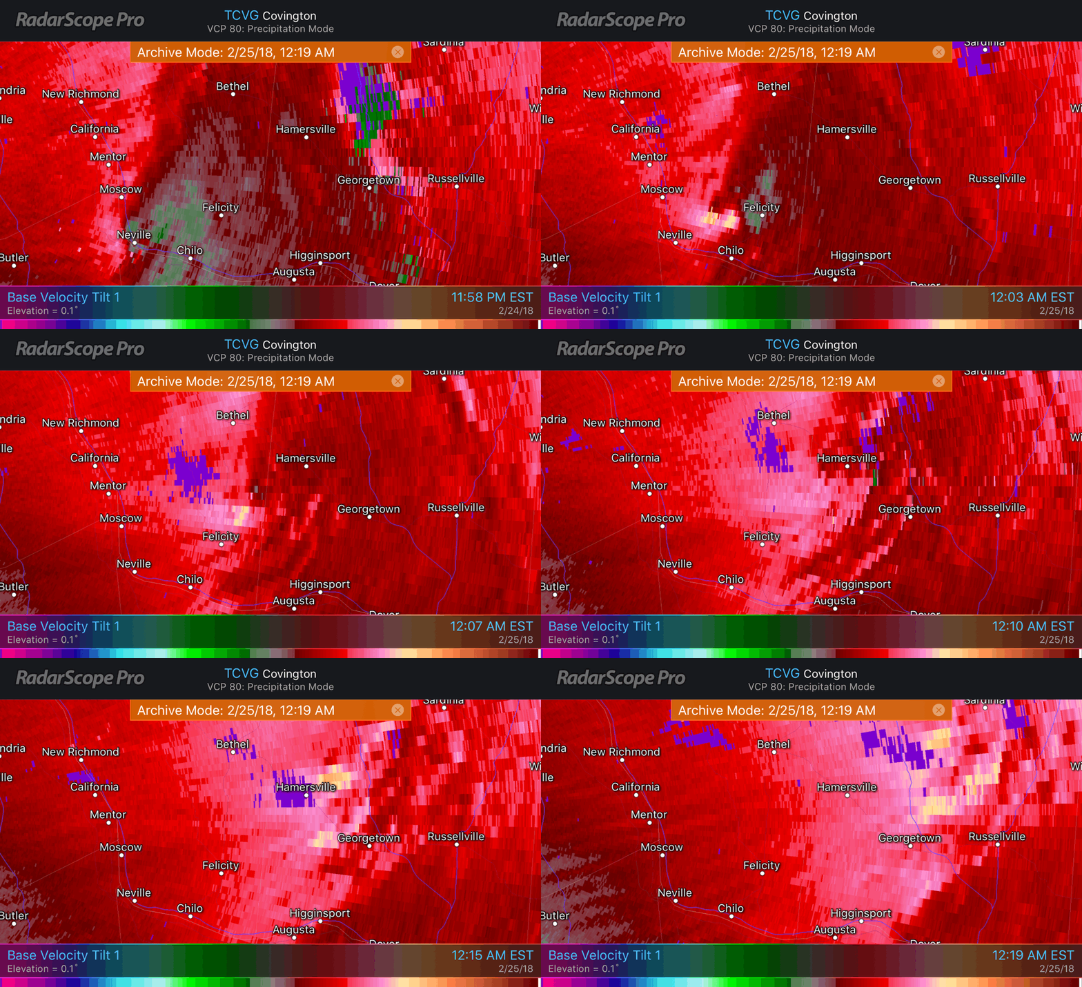
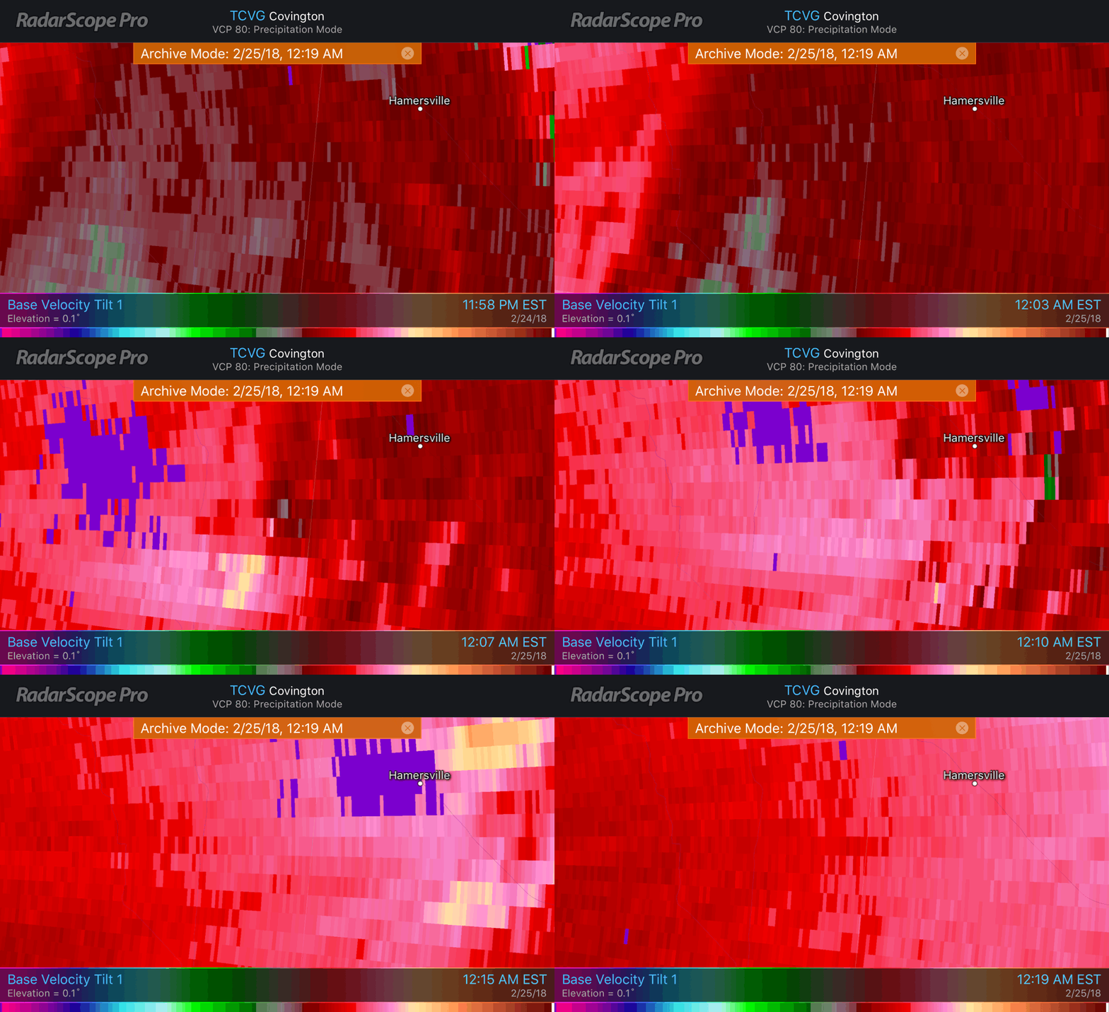
| 25FEB 25FEB TW#3 2 Touchdowns 1 Warning |
05:03 (00:03) |
Cancelled 05:16 (00:16) |
Full Info Link |
V (2018 T#1) 05:03z/00:03 EST EF1/95mph PL 3.5 mi/3 min PW 200 yds 0 inj/0 fatal Felicity, OH gif below |
3 Two Touchdowns in polygon See Next Row & Note 1 |
2 | 66% | 1 | 33% | 0 | 0% | |
| V (2018 T#2) 05:13/00:12 est EF1/90mph PL 4.9 mi/5 min PW 300 yds 0 inj/0 fatal Hamersville, OH gif below |
3 Same Warning Poly as above Note 1 |
2 | 66% | 1 | 33% | 0 | 0% | |||||
| @nwsiln issued ZERO Tornado Warnings During March 2018 | ||||||||||||
| @nwsiln issued 7 Tornado Warnings During April 2018 | ||||||||||||
| Date UTC Date Local |
Time Warning Issued UTC (EST/EDT) |
Warning Fate UTC (EST/EDT) Note 2 Below |
LINK to Full Info Note 3 Below |
Verified (V)(Tor#) False Alarm (FA) Tornado Missed (M) Under Investigation (UI) + EF?(MAX W) Path Length/Time On Grnd Path Width # Inj/# Fatalities Nearest Town |
# Warnings to Date Note 1 Below |
#False Alarms to Date |
FA Rate to Date #FA ÷ #Warn x 100 = % |
#Verifications to Date |
Verification Rate to Date #V ÷ #Warn x 100 = % |
# Missed to Date |
Missed Rate to Date #M ÷ #Tor x 100 = % |
|
| 03APR 03APR TW#4 |
20:01 (16:01) |
Expired 20:30 (16:30) |
Full Info Link |
FA | 4 | 3 | 75% | 1 | 25% | 0 | 0% | |
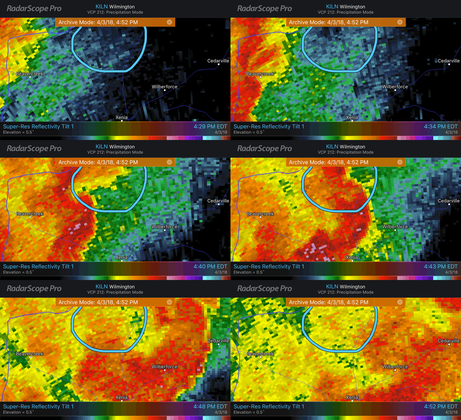
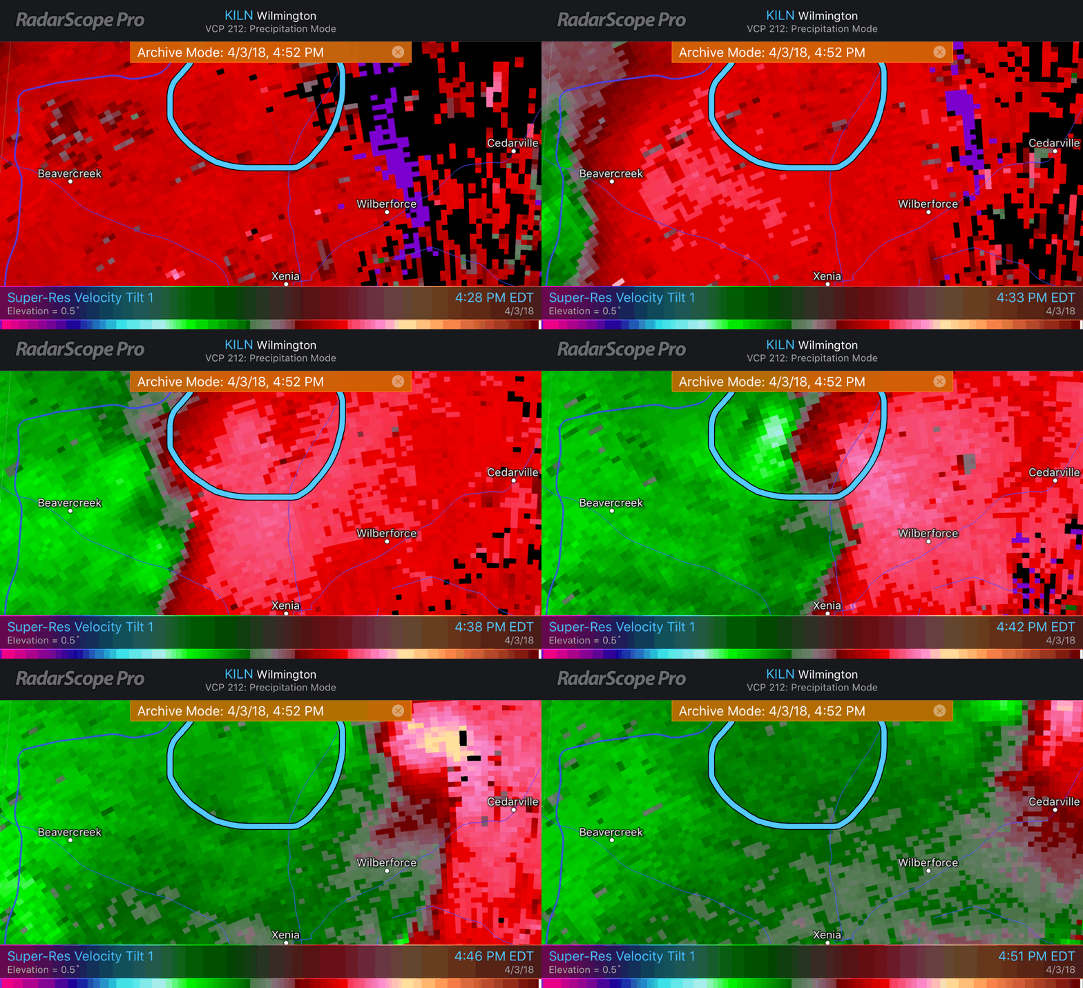
| 03APR 03APR TW#5 2 Touchdowns 1 Warning |
20:42 (16:42) |
Expired 21:15 (17:15) |
Full Info Link |
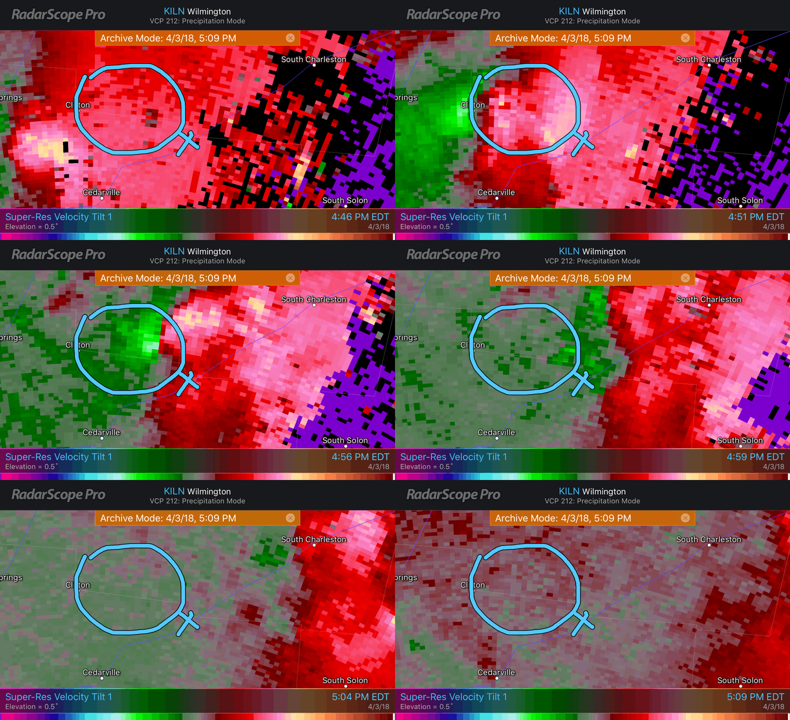
V (2018 T#3) 20:45z/16:45 EDT NWS 20:42z/16:42 EDT Radar EF1/95mph PL 8.75 mi PW 200 yds 0 inj/0 fatal NNW Xenia, OH gif below |
5 Two Touchdowns in polygon See Next Row & Note 1 |
3 | 60% | 2 | 40% | 0 | 0% | |
| V (2018 T#4) 20:56z/16:56 EDT EF1/90mph PL 4.3 mi/3 min PW 150 yds 0 inj/0 fatal nr Selma, OH gif below |
5 Same Warning Poly as above Note 1 |
3 | 60% | 2 | 40% | 0 | 0% | |||||
| 03APR 03APR TW#6 |
21:04 (17:04) |
Expired 21:30 (17:30) |
Full Info Link |
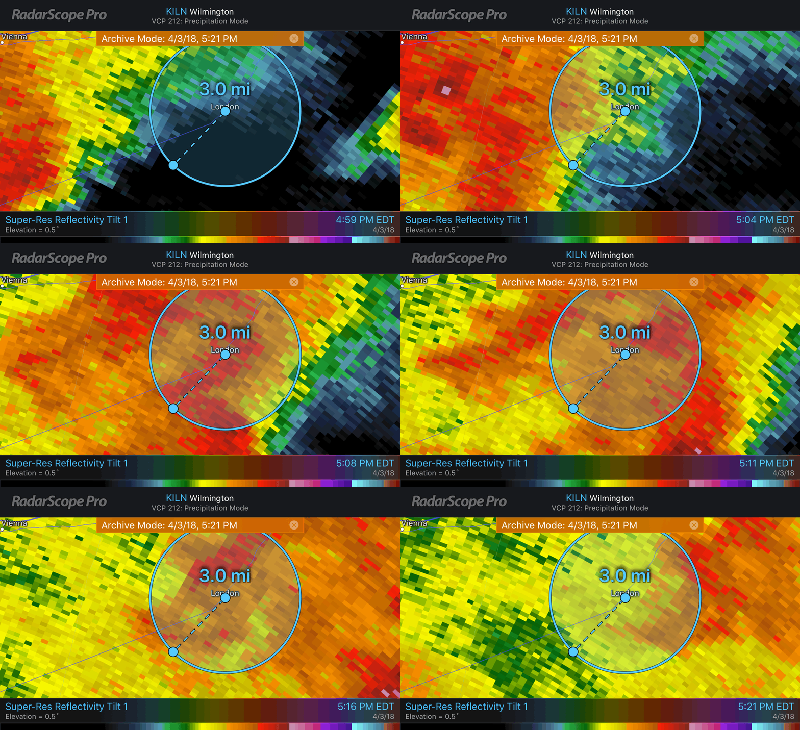
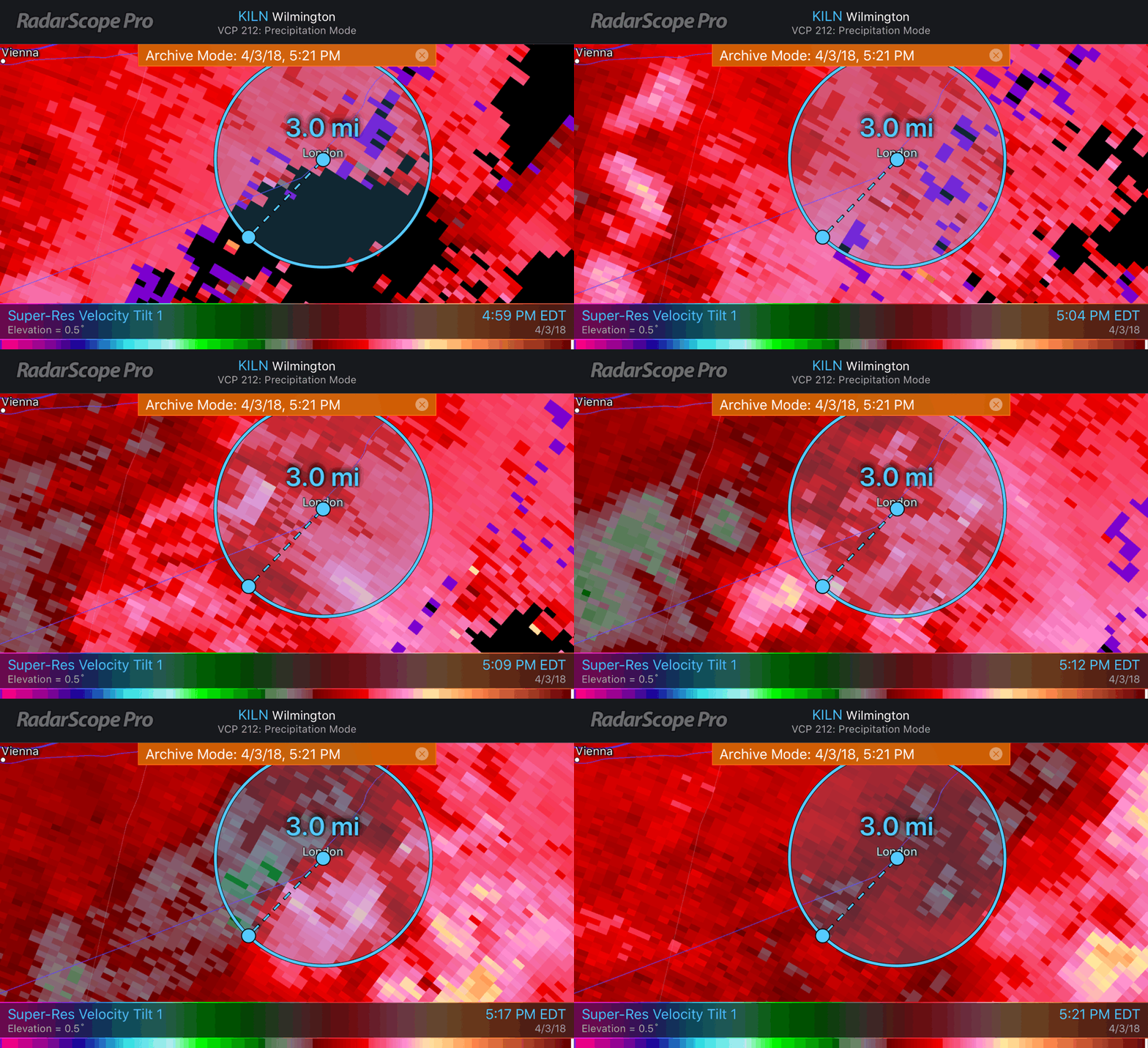
V (2018 T#5) 21:14z/17:14 EDT EF0/85mph PL 0.2 mi PW 50 yds 0 inj/0 fatal nr London, OH gif below |
6 | 3 | 50% | 3 | 50% | 0 | 0% | |
| 03APR 03APR TW#7 |
21:23 (17:23) |
Cancelled 21:49 (17:49) |
Full Info Link |
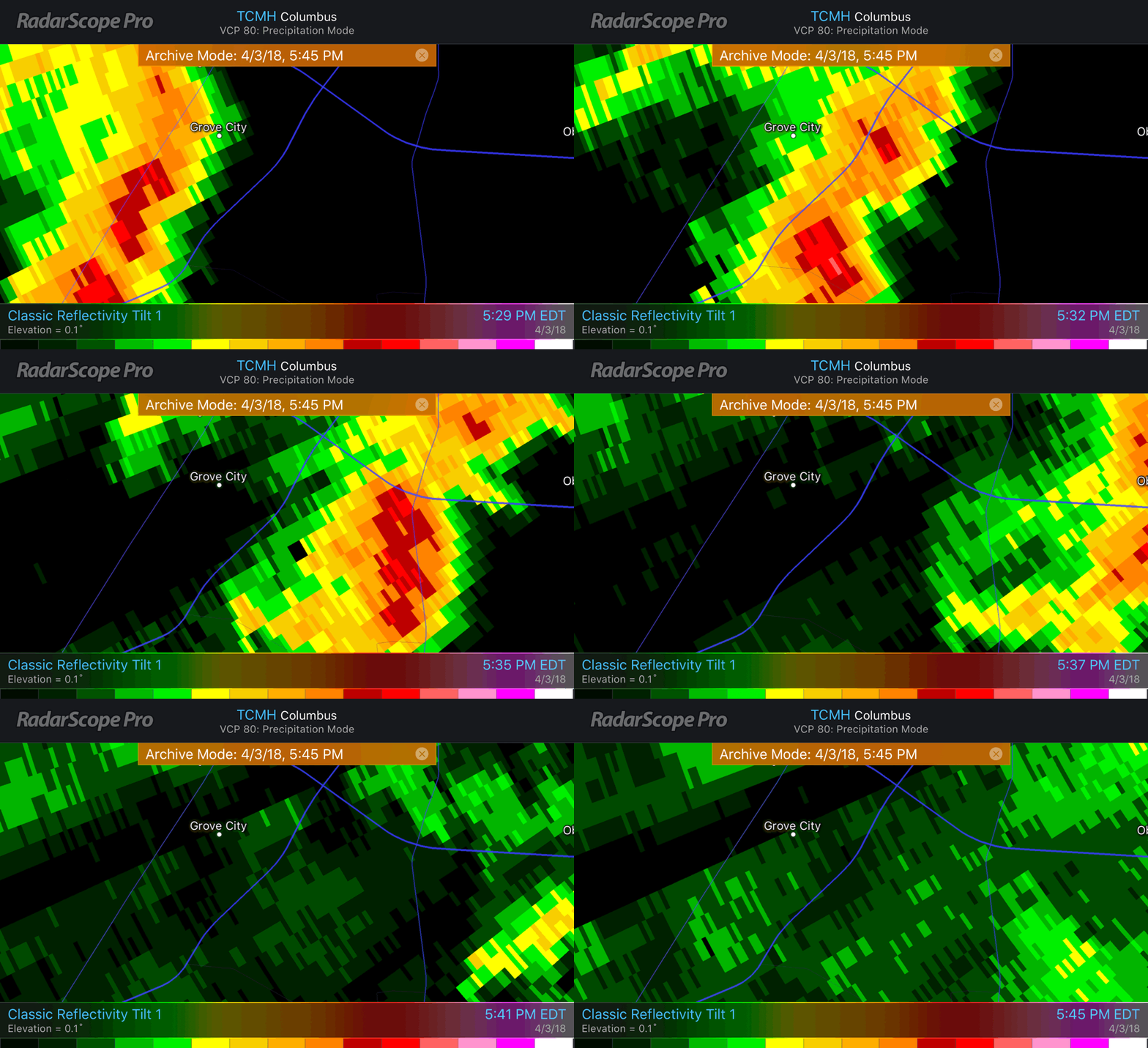
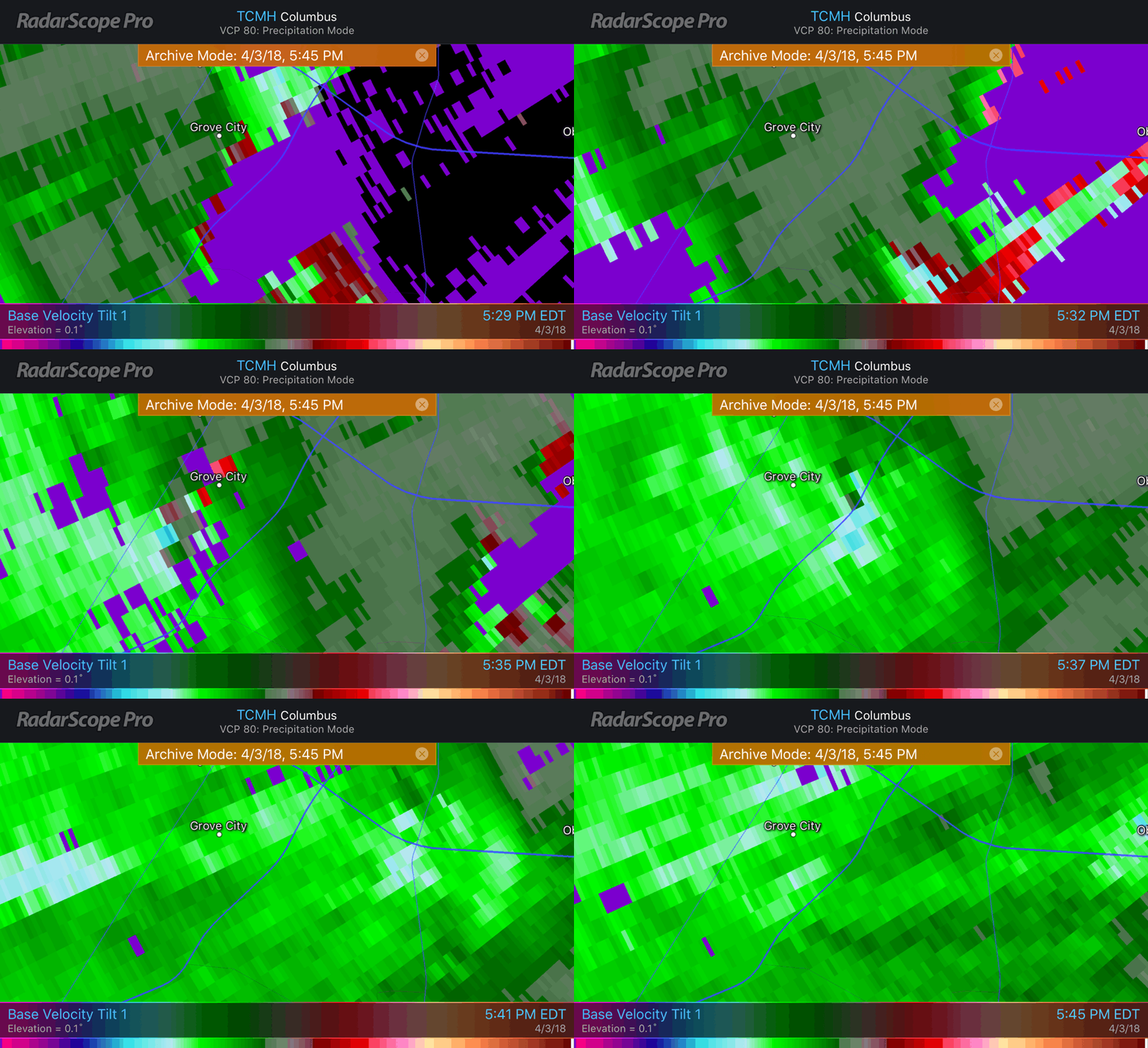
V (2018 T#6) 21:37z/17:37 EDT EF1/105mph PL 2.6 mi PW 75 yds 0 inj/0 fatal nr Grove City, OH gif below |
7 | 3 | 43% | 4 | 57% | 0 | 0% | |
| 03APR 03APR TW#8 |
21:35 (17:35) |
Expired 22:00 (18:00) |
Full Info Link |
FA | 8 | 4 | 50% | 4 | 50% | 0 | 0% | |
| 03APR 03APR TW#9 |
21:58 (17:58) |
Cancelled 22:15 (18:15) |
Full Info Link |
FA | 9 | 5 | 56% | 4 | 44% | 0 | 0% | |
| 03APR 03APR TW#10 |
22:04 (18:04) |
Cancelled 22:16 (18:16) |
Full Info Link |
FA | 10 | 6 | 60% | 4 | 40% | 0 | 0% | |
| @nwsiln issued 2 Tornado Warnings during May 2018 | ||||||||||||
| Date UTC Date Local |
Time Warning Issued UTC (EST/EDT) |
Warning Fate UTC (EST/EDT) Note 2 Below |
LINK to Full Info Note 3 Below |
Verified (V)(Tor#) False Alarm (FA) Tornado Missed (M) Under Investigation (UI) + EF?(MAX W) Path Length/Time On Grnd Path Width # Inj/# Fatalities Nearest Town |
# Warnings to Date Note 1 Below |
#False Alarms to Date |
FA Rate to Date #FA ÷ #Warn x 100 = % |
#Verifications to Date |
Verification Rate to Date #V ÷ #Warn x 100 = % |
# Missed to Date |
Missed Rate to Date #M ÷ #Tor x 100 = % |
|
| 15MAY 15MAY TW#11 |
22:00 (18:00) |
EXPIRED 22:30 (18:30) |
Full Info Link |
FA | 11 | 7 | 64% | 4 | 36% | 0 | 0% | |
| 22MAY 21MAY TW#12 |
02:04 (22:04) |
EXPIRED 02:30 (22:30) |
Full Info Link |
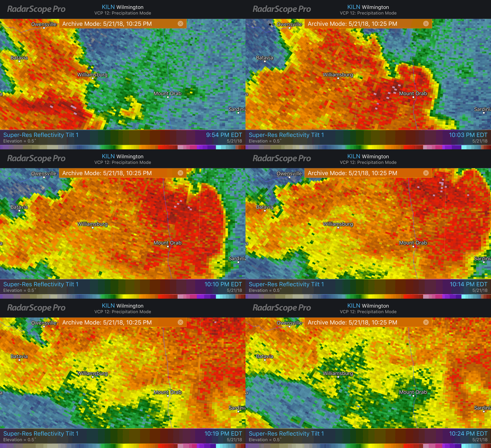
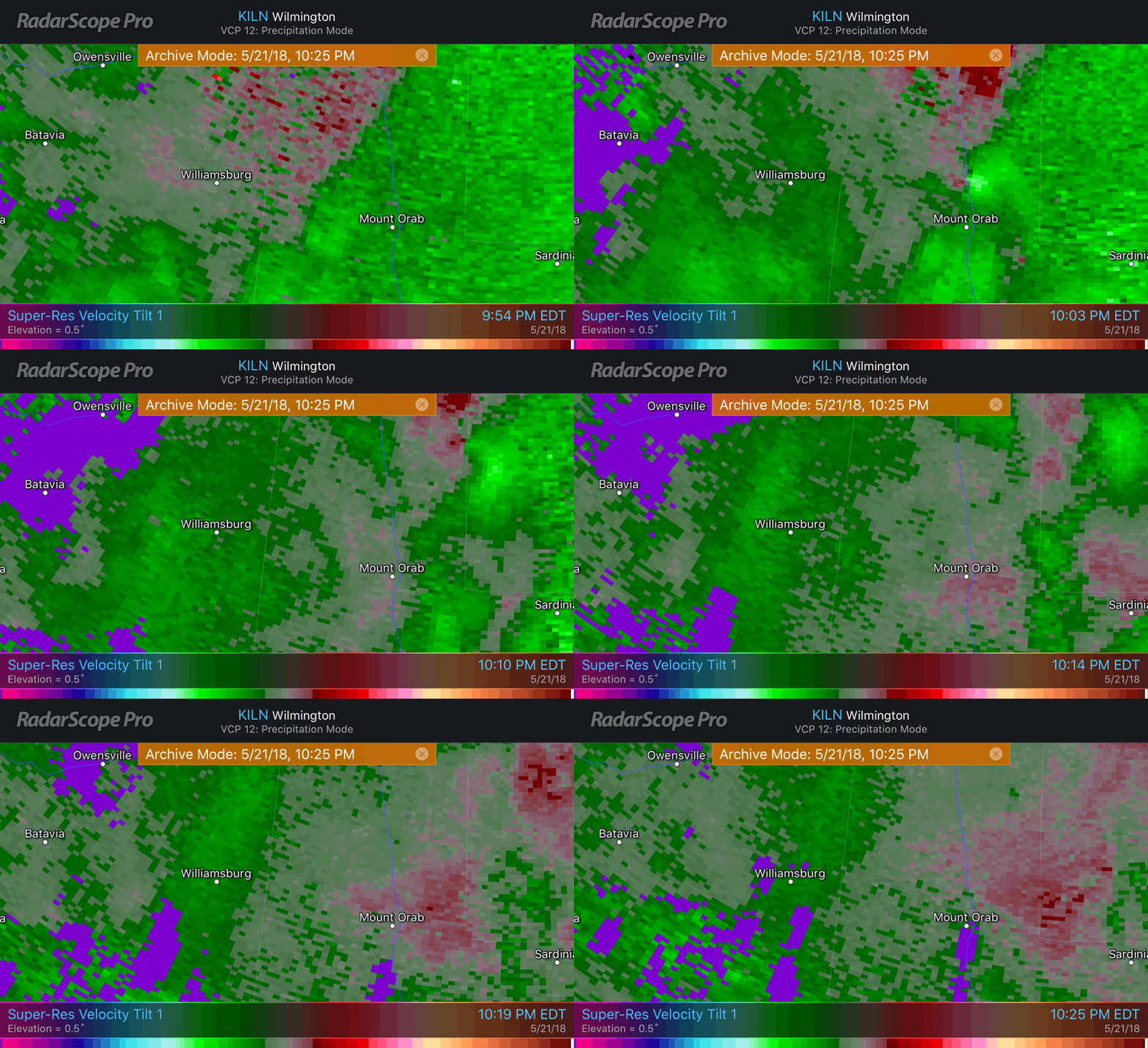
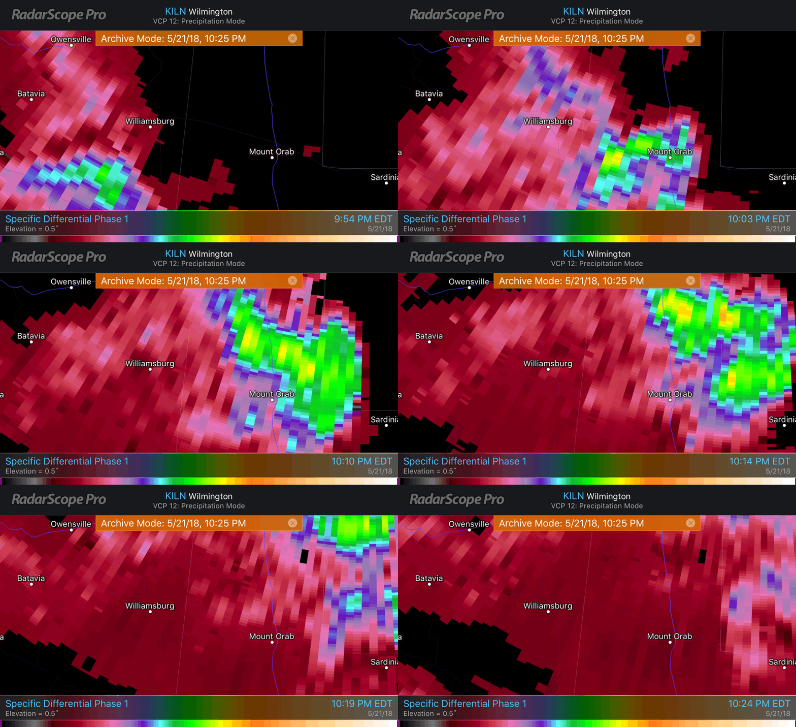
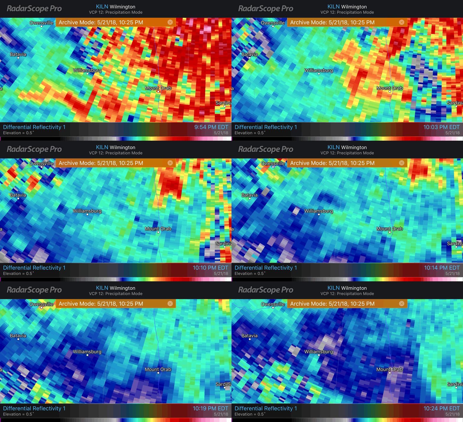
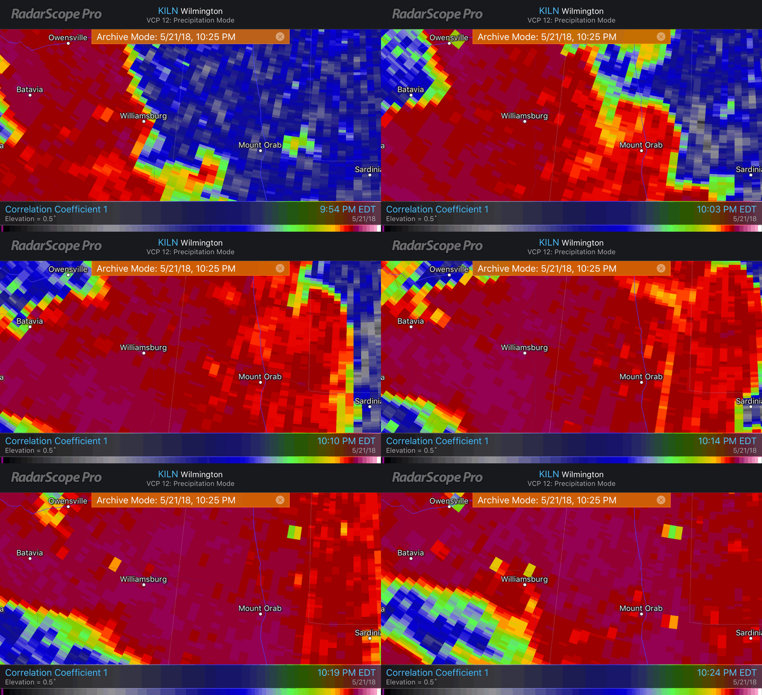
V (2018 T#7) 02:04z/22:04 EDT EF0/80mph PL 1.8mi PW 75 yds 0 inj 0/fat 2mi NNW Mt. Orab, OH gifs below |
12 | 7 | 58% | 5 | 42% | 0 | 0% | |
| @nwsiln issued ZERO Tornado Warnings During JUNE 2018 | ||||||||||||
| @nwsiln issued 1 Tornado Warning During July 2018 | ||||||||||||
| Date UTC Date Local |
Time Warning Issued UTC (EST/EDT) |
Warning Fate UTC (EST/EDT) Note 2 Below |
LINK to Full Info Note 3 Below |
Verified (V)(Tor#) False Alarm (FA) Tornado Missed (M) Under Investigation (UI) + EF?(MAX W) Path Length/Time On Grnd Path Width # Inj/# Fatalities Nearest Town |
# Warnings to Date Note 1 Below |
#False Alarms to Date |
FA Rate to Date #FA ÷ #Warn x 100 = % |
#Verifications to Date |
Verification Rate to Date #V ÷ #Warn x 100 = % |
# Missed to Date |
Missed Rate to Date #M ÷ #Tor x 100 = % |
|
| 20JUL 20JUL TW#13 |
22:27 (18:27) |
EXPIRED 19:00 (15:00) |
Full Info Link |
FA | 13 | 8 | 62% | 5 | 38% | 0 | 0% | |
| Through 08.22 @nwsiln has issued 5 Tornado Warnings During August 2018 | ||||||||||||
| Date UTC Date Local |
Time Warning Issued UTC (EST/EDT) |
Warning Fate UTC (EST/EDT) Note 2 Below |
LINK to Full Info Note 3 Below |
Verified (V)(Tor#) False Alarm (FA) Tornado Missed (M) Under Investigation (UI) + EF?(MAX W) Path Length/Time On Grnd Path Width # Inj/# Fatalities Nearest Town |
# Warnings to Date Note 1 Below |
#False Alarms to Date |
FA Rate to Date #FA ÷ #Warn x 100 = % |
#Verifications to Date |
Verification Rate to Date #V ÷ #Warn x 100 = % |
# Missed to Date |
Missed Rate to Date #M ÷ #Tor x 100 = % |
|
| 01AUG 31JUL TW#14 |
00:38 (20:38) |
Expired 01:00 (21:00) |
Full Info Link |
FA | 14 | 9 | 64% | 5 | 36% | 0 | 0% | |
| 01AUG 31JUL TW#15 |
01:04 (21:04) |
Expired 01:30 (21:30) |
Full Info Link |
FA | 15 | 10 | 67% | 5 | 33% | 0 | 0% | |
| 01AUG 31JUL TW#16 |
01:56 (21:56) |
Expired 02:15 (22:15) |
Full Info Link |
FA | 16 | 11 | 69% | 5 | 31% | 0 | 0% | |
| 01AUG 31JUL TW#17 |
02:13 (22:13) |
Expired 02:30 (22:30) |
Full Info Link |
FA | 17 | 12 | 71% | 5 | 29% | 0 | 0% | |
| 20AUG 20AUG TW#18 |
22:05 (18:05) |
Expired 22:30 (18:30) |
Full Info Link |
FA | 18 | 13 | 72% | 5 | 28% | 0 | 0% | |
| NOTE 1: A single storm may occupy several warning polygons during its lifetime. Each polygon is an entry in the table. If more than one tornado touches down in a warning polygon it is counted as one verified warning. A single tornado can lift and touch down again in the same polygon. Multiple tornadoes in a single polygon = 1 verification. Decatur Co. IN warnings are included because they are part of the FOX19 NOW viewing area but not part of the @nwsiln area of responsibiity. They are not part of the verification, false alarm and missed rates statistics calculated for the table. | ||||||||||||
| NOTE 2: There are a number of reasons a tornado warning can be cancelled they include: a warning that should never have been issued, the storm weakens or rotation disappears, the storm moves out of the warning polygon, in which case the warning may be extended into a new polygon. Often when the NWS is very busy or the storm weakens a short time before the expiration, the warnings are allowed to expire after notifyng the public without additional comment. | NOTE 3: Courtesy: Iowa State University, Iowa Environmental Mesonet, VTEC Browser. | |||||||||||
Click For Online Jigsaw Puzzle Page |
Click For Online Slide Puzzle Page |

|

|
| 
|
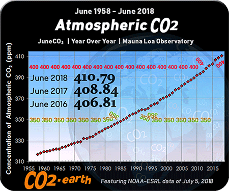
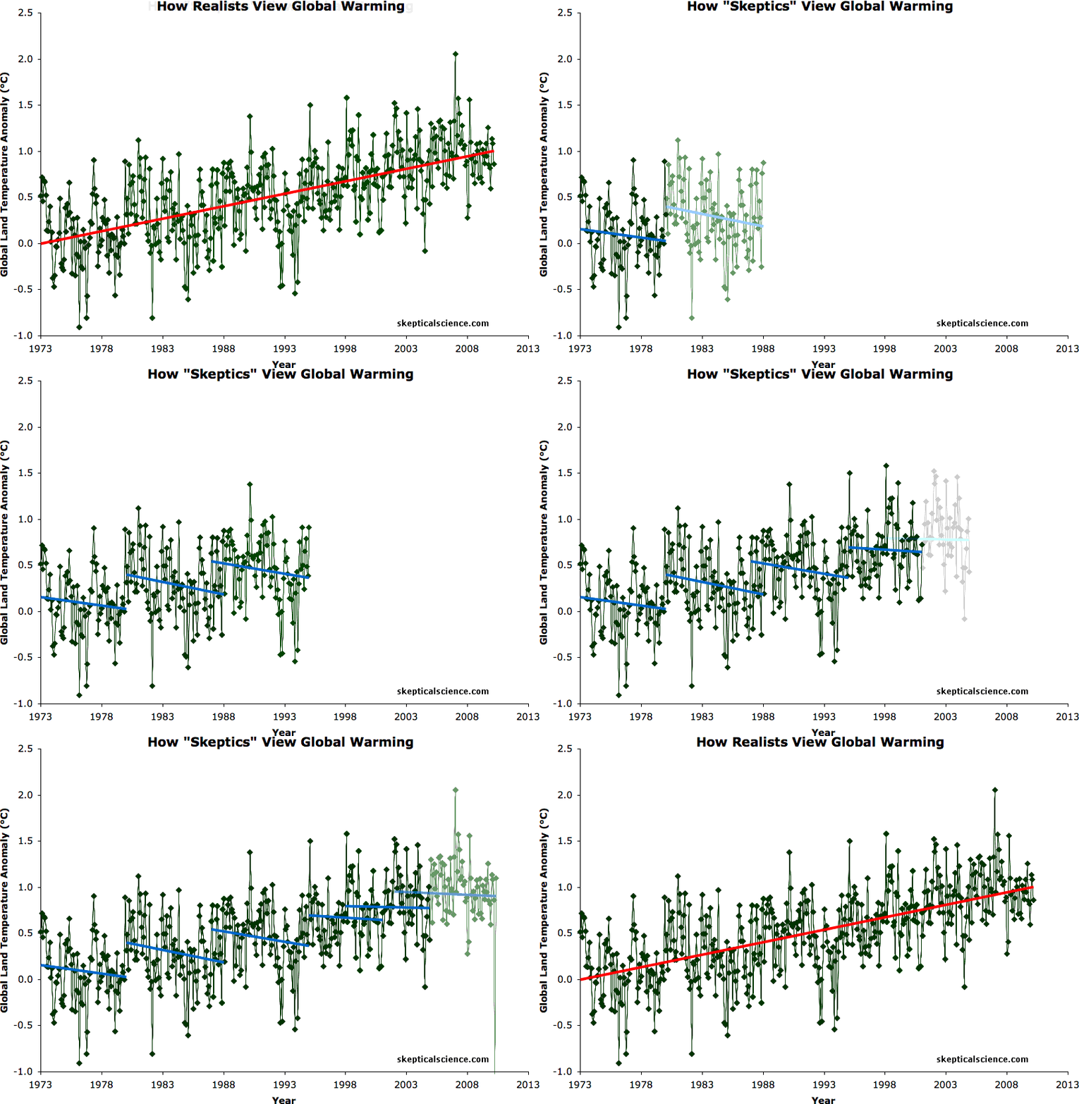
Courtesy: skepticalscience.com Click For More Information |
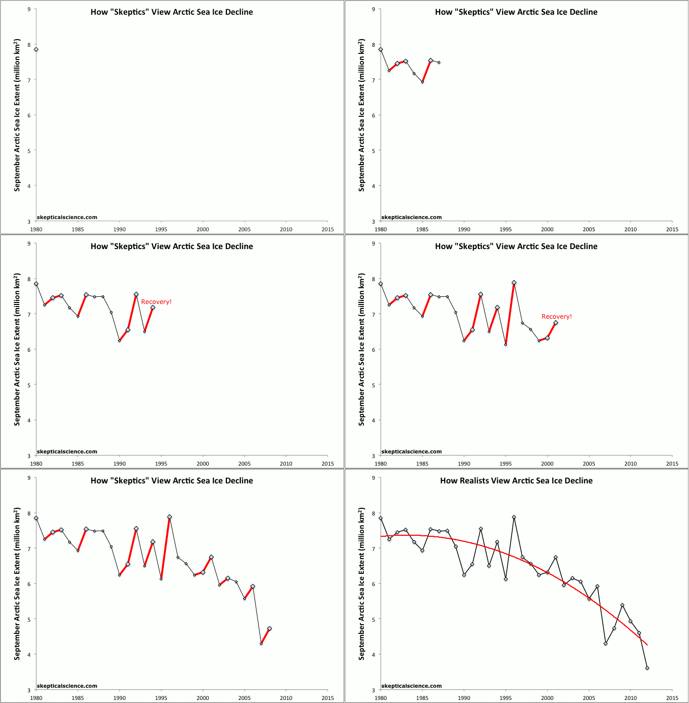
Courtesy: skepticalscience.com Click For More Information |
|
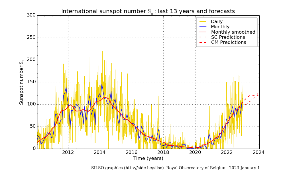
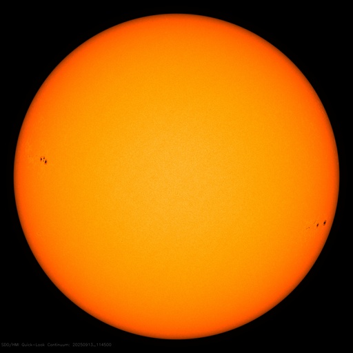
Number of sunspots over the last month |
|
|
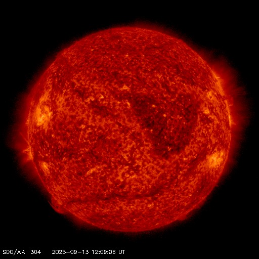
|
Ionized Helium Shows Sunspots Gasses @ 6000oK 11,000oF |
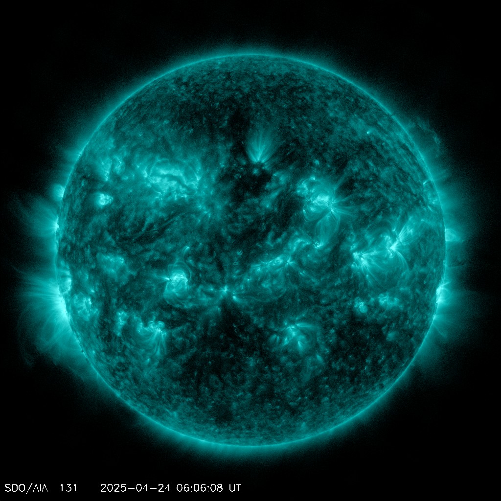
Ionized Iron Shows Solar Flares Gases @ 10 millionoK 18 millionoF |
Ionized Helium Shows Filaments and Prominances @ 50,000oK 90,000oF |
| John A. Roebling Suspension Bridge,
completed just after the Civil War, it was the first permanent structure to span the Ohio River. Roebling used multi-strand cables for the first time on so long a structure marking a great leap forward in bridge engineering. This was the prototype for the Brooklyn Bridge and my favorite Cincinnati landmark. |
|
|---|---|
 |
 |
| January 19, 1994, 7:25 AM, Steam Fog on the Ohio River Temperature -24℉. |
April 2, 1997 from Covington, KY Note the comet Hale-Bopp just above the center of the bridge. |
| Site Index | |
|---|---|
| |
 |
| Cincinnati Area Tornado Photos |
Cincinnati Archive Weather Data |
 |
Sep. 2008 Hurricane Ike Wind Animation CLICK HERE
Ike Satellite Animation - During Extratropical Transition CLICK HERE
Compare Ike to
The 1900 Great Galveston Hurricane CLICK HERE
Oxford, OH Hook Echo of June 3, 2008
CLICK HERE For Reflectivity and Velocity Images from NWS ILN NEXRAD Doppler
CVG Radar Images from April 3, 1974 and a Satellite Loop
CLICK HERE See What a Meteorologist in the 70's Used to Forecast (Below the Photos)
| |
| Cincinnati Area Tornado Photos |
 |
For a few weather "explainers" on a variety of topics click HERE
 |

